.png)
CNN —
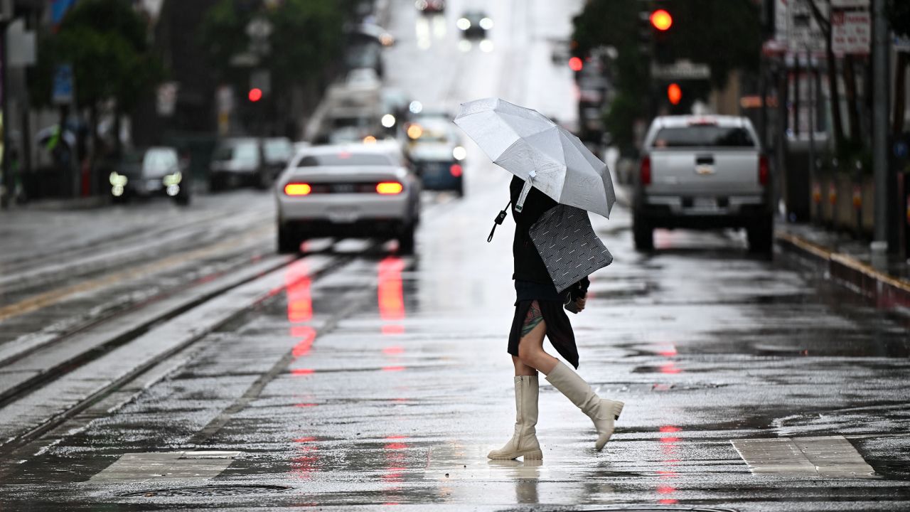
A powerful Pacific storm isn’t finished battering California, as the state enters day two of heavy rainfall, mountain snow, gusty winds and the potential for severe weather.
The system already left parts of Interstate 5 closed from California into Oregon Tuesday due to the extreme winter conditions, the Oregon Department of Transportation said. The harsh weather also caused disruptions to San Francisco Bay Ferry service Tuesday, and power outages impacted tens of thousands.
The multiday storm comes as the state has already been slammed by at least 12 atmospheric rivers that have delivered a barrage of rain and snow in recent months.
Waterlogged California will continue to see rain through the day Wednesday and Thursday as an additional 1 to 3 inches are expected between the Bay Area and Southern California.
Check your latest forecast here
“Rain rates could briefly reach a half inch per hour,” the National Weather Service office in Los Angeles warned. “Also can’t rule out waterspouts over the ocean and small tornadoes over land.”
The warning comes just one week after a rare tornado struck near Los Angeles, sending debris flying, collapsing the roof of a building and snapping a power pole.
While this system may not have as extreme rainfall totals as we have seen with past atmospheric river events, huge impacts could still be felt simply because the soil is so saturated from the unprecedented winter.
Wednesday and Thursday’s rain could bring the possibility of additional flooding across the state.
The Weather Prediction Center has issued a marginal risk of flooding for the areas impacted by this system.
“Rainfall rates may briefly peak at 0.25-0.5”/hr while relatively quick moving across the southern part of the Marginal Risk, but saturated soils could support a localized flooding/rapid runoff threat,” the prediction center said.
In addition to flooding, the rain could lead to more landslides and rockslides across the state.
“We still have road closures in the mountainous areas because of the sheer number of landslides and rockslides since we have been impacted by so many storm systems,” weather service meteorologist Roger Gass told CNN.
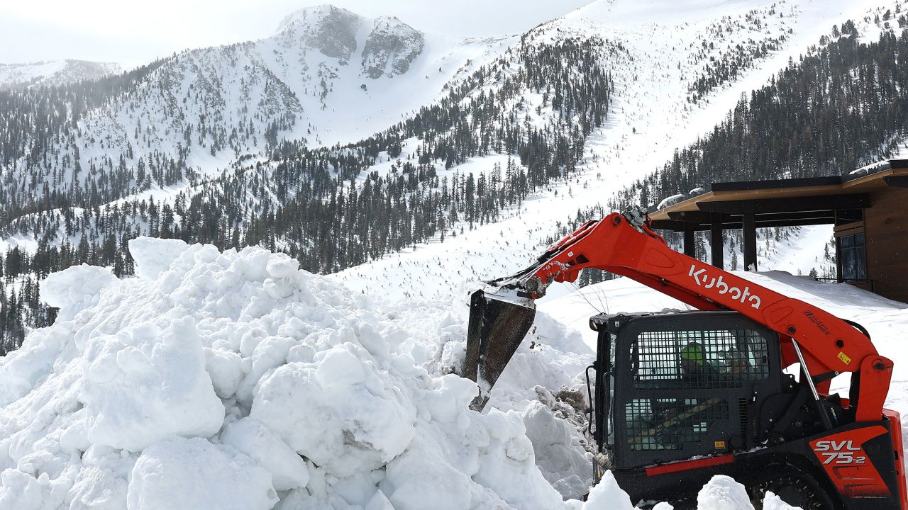
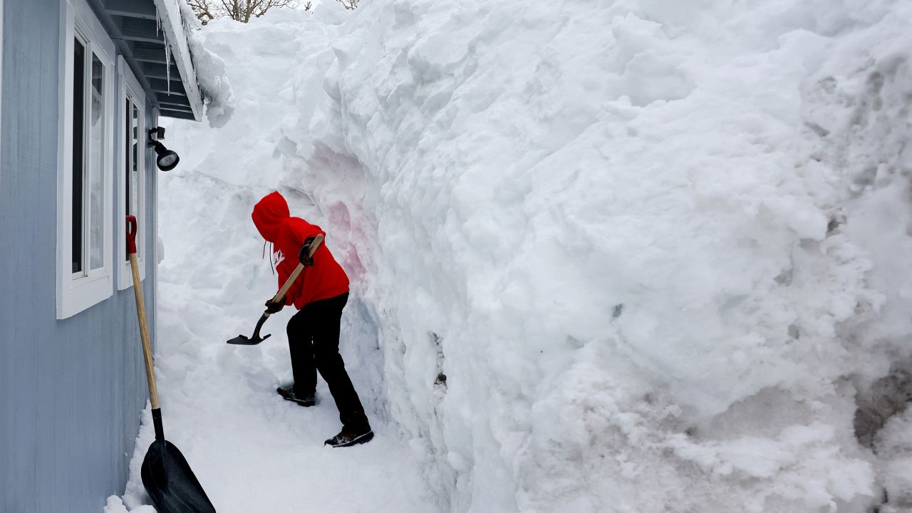
In the higher elevations, as much as 3 to 4 feet of additional snow could fall across the already record-breaking California snowpack.
In the central Sierra Mountains, a warning of “large avalanches” has been issued for backcountry areas around Tahoe.
“A powerful storm with gale force winds and high intensity snowfall will lead to widespread avalanche activity in the mountains,” the weather service warned. “Large avalanches could occur in a variety of areas.”
Gusty winds could lead to potential power outages as winds are forecast to gust as high as 50 mph with this storm system.
High winds will extend far inland as well, impacting the Great Basin, Desert Southwest and Southern Rockies as this storm pushes east.
“These high winds are forecast to continue into the Southern Rockies Thursday, with gusts upwards of 70 mph possible,” the prediction center warned.
The storm will move out of California by Thursday evening, leaving much cooler and drier conditions in place through the rest of the week.
Temperatures are running 10 to 15 degrees below the late-March average across the state. A gradual warmup will occur through the weekend.


 English (US) ·